FlyWay 0.4.1
Plan and visualize your fly routes
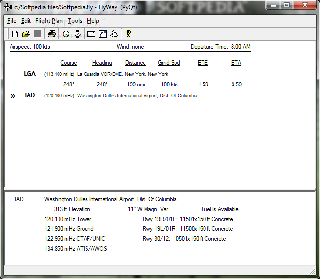
Flyway allows the user to find and enter U.S. waypoints (airports, navaids, and fixes), then it calculates courses, wind corrections, and travel times. Information about the waypoints is provided (including frequencies, elevation, fuel availability, and runway descriptions).
The route data can also be used to fill in an editable FAA Flight Plan form, fetch basic weather information from the internet, and display a very rough map.
Give FlyWay a try to see juts how useful it can actually be for you!
· Includes waypoint data for most U.S. airports, navigational aids and fixes.
· Searches for waypoints by comparing keywords to the waypoint identifier, the name, the city or the state.
· Provides information about the waypoints, including various frequencies, elevation, fuel availability, and runway descriptions.
· Calculates courses, wind corrections, and travel times for a route.
· The route data can be used to fill in an editable FAA Flight Plan Form.
· Weather information, including surface observations, terminal forecasts and winds aloft data, can be displayed for stations near the route.
· The route data, the waypoint information, the flight plan, and the weather data may be printed.
· A rough map may be displayed to show the relationship of the route waypoints and other waypoints.
What’s New in This Release:
Updates:
· The waypoint database has been updated to the most recent data available. It was labeled as current in May 2005. The US government has halted the distribution of data, so future updates are unlikely.
Bug Fixes:
· A problem opening files with the latest versions of the PyQt library has been fixed.