HEMS Tool
A utility designed to meet the needs of low-altitude VFR emergency first responders
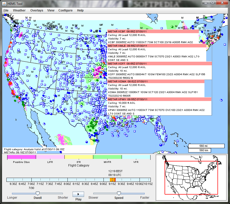
The HEMS (Helicopter Emergency Medical Services) Tool can overlay multiple fields of interest: ceiling, visibility, flight category, winds, relative humidity, temperature, radar (base and composite reflectivity), AIRMETs and SIGMETs, METARs, TAFs, and PIREPs.
All 3D data are interpolated to AGL altitudes and can be sliced horizontally on 500 ft intervals up to 5000 ft. All data can be animated in time.
The tool has high-resolution basemaps, including streets, hospitals, and heliports for the entire United States. More detail is revealed as you zoom in. Preferred views can be saved for quick recall later.
Take HEMS Tool for a test drive to fully assess its capabilities and see what it can actually do for you!
· AGL interpolated data for low altitude flight
· Time animation of evolving weather
· High-resolution basemaps
· Saving of preferred views
Requirements:
· Java 1.6 or later
· 512MB of RAM